How to Set Up a GNSS Base Station on Site

Step-by-Step Guide for Construction, Survey and Machine Control

Setting up a GNSS base station correctly is critical to achieving accurate and reliable positioning for machine control, survey and site operations.

At QuipTech Solutions, we regularly support clients with base station setups across construction, civil and mining projects. This guide outlines the practical steps to get your system up and running properly.


What You Need Before You Start

Before setting up your base station, make sure you have:

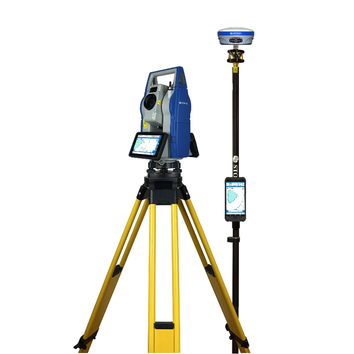
  • GNSS receiver (e.g. **Stonex SR35, S880, S1000)
  • Tripod and tribrach
  • Antenna or integrated receiver
  • Radio (UHF) or 4G/NTRIP setup
  • Power supply (battery or external)
  • Controller or software
  • Known point (if available)

Step 1: Choose the Right Location

The base station location is critical.

Best practice

  • Clear view of the sky (minimal obstructions)
  • Elevated position where possible
  • Away from buildings, trees and machinery
  • Stable ground (no movement or vibration)

👉 Poor location = poor accuracy.


Step 2: Set Up the Tripod

  • Extend tripod legs evenly
  • Position directly over your control point (if known)
  • Ensure the tripod is stable and secure

👉 Accuracy starts here — take your time.


Step 3: Mount and Level the Receiver

  • Attach the GNSS receiver or antenna
  • Use a tribrach or mount to level accurately
  • Check height measurement (critical for accuracy)

👉 Record your antenna height correctly.


Step 4: Configure the Base Station

Using your controller/software:

Set base mode

  • Select Base Station Mode

Input position

  • Known point (recommended for construction sites)
    OR
  • Autonomous position (temporary setups)

Set correction format

  • RTCM (standard format for compatibility)

Step 5: Set Up Communication Method

Option 1: UHF Radio

  • Set frequency (licensed band)
  • Match rover radio settings
  • Select transmission power (5W / 35W)

Option 2: NTRIP / 4G

  • Insert SIM card
  • Configure network settings
  • Connect to correction server

Option 3: Starlink / Site Network

  • Connect base to router
  • Enable NTRIP broadcasting
  • Ensure stable internet connection

👉 Choose the method based on your site conditions.


Step 6: Start Broadcasting Corrections

  • Activate base station
  • Confirm RTK corrections are transmitting
  • Check rover connection

👉 Always verify before starting work.


Step 7: Test Accuracy on Site

Before full operation:

  • Check position against known points
  • Verify consistency across machines/rovers
  • Confirm no dropouts in signal

👉 This step prevents costly mistakes later.


Common Mistakes to Avoid

❌ Poor base location (obstructions)
❌ Incorrect antenna height
❌ Wrong radio frequency
❌ Unstable tripod setup
❌ Not verifying accuracy before use


UHF vs Network Setup – Quick Guide

Setup TypeBest For
UHF RadioRemote sites, mining
4G / NTRIPUrban areas
StarlinkRemote + connected hybrid

Pro Tips from QuipTech

  • Always use a known control point where possible
  • Keep base station secure and protected
  • Use high-power UHF (35W) for large sites
  • Consider backup communication (4G + radio)
  • Regularly check calibration and setup

Complete Base Station Solutions

QuipTech Solutions can supply and support:

  • Stonex GNSS base stations
  • UHF radio systems (5W / 35W)
  • 4G and Starlink connectivity
  • Controllers and software
  • Site setup and commissioning
  • Training and support

👉 We ensure your system is set up correctly from day one.


Need Help Setting Up Your Base Station?

If you’re unsure about your setup or want a fully configured solution, QuipTech Solutions can help.

Contact us to:

  • Configure your base station
  • Set up RTK corrections
  • Integrate with machine control
  • Ensure accuracy across your site

Request a Quote | Talk to Our Team | Book a Demo

Stonex Base Stations for Machine Control

Reliable RTK Correction Solutions for Construction, Civil and Mining

Stonex base stations play a critical role in delivering accurate, reliable positioning for machine control systems across construction, civil and mining projects.

At QuipTech Solutions, we supply and configure Stonex GNSS base stations to provide consistent RTK correction data to excavators, dozers, graders and survey rovers — ensuring machines operate with precision and efficiency on site.


What is a GNSS Base Station for Machine Control?

A GNSS base station is a fixed receiver that calculates its precise position and transmits correction data to machines and rovers on site.

This allows:

  • Centimetre-level accuracy for machine control
  • Consistent positioning across all machines
  • Reliable site-wide performance

👉 Without a base station, machine control systems cannot achieve the accuracy required for construction work.


How Stonex Base Stations Work with Machine Control

Stonex base stations integrate seamlessly into machine control environments by:

Broadcasting RTK Corrections

  • UHF radio (5W / 35W options)
  • NTRIP via 4G / Starlink
  • Site network solutions

Supporting Multiple Machines

  • Excavators
  • Dozers
  • Graders
  • Survey rovers

👉 One base station can support multiple machines across a site.


Providing Consistent Accuracy

  • Eliminates variation between machines
  • Ensures all operators are working from the same reference
  • Reduces rework and improves productivity

Key Benefits of Stonex Base Stations

High-Accuracy Positioning

  • RTK centimetre-level accuracy
  • Stable correction delivery
  • Reliable performance across site conditions

Flexible Communication Options

  • UHF radio for remote sites
  • 4G / NTRIP for network-based correction
  • Starlink integration for remote connectivity

Compatibility with Machine Control Systems

  • Works alongside mixed fleet environments
  • Supports open RTCM correction formats
  • Suitable for integration with multiple brands

👉 A major advantage over proprietary systems.


Cost-Effective Site Setup

  • Lower cost compared to traditional systems
  • Scalable across multiple machines
  • Reduced reliance on external correction services

UHF vs Network RTK for Machine Control

MethodBest UseKey Advantage
UHF RadioRemote sitesIndependent, reliable coverage
4G / NTRIPUrban / connected sitesNo local base required
StarlinkRemote + connected sitesHigh reliability internet

👉 Many sites use a hybrid approach depending on conditions.


Applications for Stonex Base Stations

Construction Sites

Providing consistent positioning for excavators and earthmoving equipment.


Civil Infrastructure Projects

Supporting large-scale operations with multiple machines and crews.


Mining Operations

Reliable RTK correction in remote and harsh environments.


Survey and Machine Control Integration

Ensuring survey teams and machine operators work from the same data.


Complete Machine Control Solutions from QuipTech

QuipTech Solutions specialises in delivering complete site setups, including:

  • Stonex GNSS base stations
  • Rover units and survey equipment
  • Machine control integration support
  • UHF radio configuration (5W / 35W)
  • 4G and Starlink connectivity
  • Site network setup
  • Training and technical support

👉 Ensuring your system is fully operational and reliable.


Why Choose Stonex for Machine Control Base Stations

Stonex provides a strong combination of:

  • Reliable GNSS performance
  • Flexible communication options
  • Open system compatibility
  • Lower cost compared to traditional brands

👉 Making it a practical solution for modern construction sites.


Why Work with QuipTech Solutions

QuipTech Solutions focuses on delivering real-world, working systems, not just equipment.

We help clients:

  • Design site-wide RTK solutions
  • Configure base stations correctly
  • Integrate with machine control systems
  • Ensure reliable communication across site
  • Provide ongoing support

Get a Quote on Stonex Base Stations

If you need a GNSS base station for machine control in Australia, QuipTech Solutions can help you build the right setup for your site.

Contact our team to:

  • Configure a base station system
  • Compare UHF vs network RTK
  • Build a complete machine control solution
  • Arrange a demo

Request a Quote | Talk to Our Team | Book a Demo

Stonex SR35 GNSS Receiver – UHF Radiomodem (5W / 35W)

High-Power GNSS Rover with Integrated Radio for Reliable RTK Positioning

The Stonex SR35 with UHF radiomodem (5W / 35W) is a powerful GNSS solution designed for reliable RTK positioning in environments where network coverage is limited or unavailable.

Available through QuipTech Solutions, this configuration provides strong radio transmission capability, making it ideal for base station setups, remote sites and large-scale construction projects.


Integrated UHF Radio for RTK Corrections

The SR35 UHF version includes an internal radiomodem capable of:

  • 5W transmission for standard site coverage
  • Up to 35W transmission for extended range applications
  • Stable RTK correction broadcasting
  • Reliable communication between base and rover

👉 This allows survey teams to operate independently of mobile networks.


Why UHF Radio Matters

While 4G/NTRIP solutions are common, many sites still require radio-based correction delivery.

Ideal for:

  • Remote and regional projects
  • Mining operations
  • Large civil construction sites
  • Areas with poor or no mobile coverage
  • Secure, standalone site setups

👉 UHF ensures consistent, uninterrupted RTK corrections where network solutions may fail.


Flexible Base and Rover Configuration

The Stonex SR35 with UHF can be configured as:

Base Station

  • Broadcast RTK corrections via UHF radio
  • Support multiple rovers on site
  • Ideal for dedicated project setups

Rover Unit

  • Receive corrections from UHF base
  • Maintain high-accuracy positioning
  • Operate independently of mobile networks

Key Features

GNSS Performance

  • Multi-constellation tracking (GPS, GLONASS, Galileo, BeiDou)
  • RTK centimetre-level accuracy
  • Fast convergence times

UHF Radiomodem

  • 5W / 35W transmission options
  • Long-range communication capability
  • Reliable correction delivery

Field-Ready Design

  • Rugged construction
  • Suitable for harsh site conditions
  • Compact and portable

Connectivity Options

  • UHF radio
  • Bluetooth and Wi-Fi
  • Optional 4G / NTRIP support

👉 Allows flexible deployment across different site requirements.


Applications for SR35 UHF Systems

Remote Construction Projects

Reliable positioning where mobile coverage is limited.


Mining and Resource Projects

Stable RTK correction across large, isolated sites.


Civil Infrastructure

Dedicated base station setups for consistent site-wide accuracy.


Machine Control Support

Providing correction data to multiple machines and rovers.


UHF vs Network RTK (4G/NTRIP)

FeatureUHF RadioNetwork RTK
CoverageSite-basedNetwork dependent
Reliability✅ High⚠️ Variable
SetupRequires baseNo base needed
Best UseRemote sitesUrban areas

👉 Many projects use both, depending on conditions.


Why Choose the SR35 UHF from QuipTech

QuipTech Solutions specialises in delivering complete RTK solutions, not just hardware.

When you choose the SR35 UHF system, you get:

  • Correct base station setup advice
  • Radio configuration support
  • Frequency and licensing guidance
  • Integration with survey and machine control systems
  • Ongoing technical support

Complete UHF RTK Solutions

We can supply full systems including:

  • SR35 base and rover units
  • UHF radio configuration
  • Tripods, poles and accessories
  • Controllers and software
  • Site communications integration
  • Training and commissioning

👉 Delivering a fully operational RTK setup.


Get a Quote on the Stonex SR35 UHF

If you need a high-power GNSS receiver with UHF radio in Australia, the Stonex SR35 is a practical and reliable solution.

Contact QuipTech Solutions to:

  • Request pricing
  • Configure a base and rover system
  • Understand licensing requirements
  • Arrange a demo

Request a Quote | Talk to Our Team | Book a Demo

Stonex S1000 GNSS Receiver

Next-Generation GNSS Performance for Survey, Construction and Machine Control

The Stonex S1000 is a next-generation GNSS receiver designed to deliver high-precision positioning, advanced IMU functionality and reliable RTK performance across construction, civil and mining applications.

Available through QuipTech Solutions, the S1000 is built for professionals who need maximum efficiency, accuracy and performance in demanding site environments.


Advanced GNSS Technology

The Stonex S1000 is equipped with modern GNSS capabilities designed to perform in challenging conditions.

Key GNSS features

  • Multi-constellation tracking (GPS, GLONASS, Galileo, BeiDou)
  • High channel count for improved signal tracking
  • Fast RTK convergence
  • Stable positioning in obstructed environments

👉 Ensures consistent, reliable accuracy across all site conditions.


IMU Tilt Compensation Technology

One of the standout features of the S1000 is its advanced IMU tilt compensation, allowing surveyors to measure points without perfectly levelling the pole.

Benefits include:

  • Faster point collection
  • Increased productivity
  • Safer operation in difficult terrain
  • Reduced setup time

This is particularly valuable in construction and civil environments where speed and efficiency matter.


Built for High-Performance Field Work

The S1000 is designed to handle demanding site conditions across Australia.

  • Rugged, field-ready construction
  • Suitable for dust, vibration and harsh weather
  • Reliable performance across long working days

👉 Ideal for both metro construction sites and remote mining operations.


Connectivity and Flexibility

Modern workflows require strong connectivity and system integration.

Connectivity options

  • 4G / NTRIP support
  • Bluetooth and Wi-Fi
  • Internal radio capability (depending on configuration)

This allows the S1000 to operate across:

  • Network RTK environments
  • Base and rover setups
  • Remote site deployments

Applications for the Stonex S1000

Construction Setout

Accurate and efficient layout of design points across civil projects.


Surveying

Reliable data collection for boundaries, verification and site control.


Civil and Infrastructure Projects

High-performance GNSS for large-scale developments.


Mining and Remote Operations

Strong positioning capability combined with flexible communications solutions.


Machine Control Support

Providing positioning data for machine guidance and site base stations.


Why Choose the Stonex S1000

The S1000 is designed for users who require premium performance without the premium price tag.

Key advantages

  • High-precision RTK positioning
  • Advanced IMU tilt technology
  • Reliable GNSS performance
  • Flexible across mixed systems
  • Strong value compared to traditional premium brands

Complete GNSS Solutions from QuipTech

QuipTech Solutions supplies the Stonex S1000 as part of a complete system, including:

  • Base and rover kits
  • Survey controllers and tablets
  • RTK correction setup
  • Site communications (4G and Starlink)
  • Accessories and mounting solutions
  • Training and technical support

👉 Delivering a fully integrated, field-ready solution.


Stonex S1000 vs Traditional Systems

Compared to traditional premium GNSS systems, the S1000 offers:

  • Comparable real-world performance
  • Greater flexibility
  • Lower overall cost
  • Faster deployment

👉 Making it a strong choice for contractors and survey professionals.


Get a Quote on the Stonex S1000

If you are looking for a high-performance GNSS receiver in Australia, the Stonex S1000 is a powerful solution for survey, construction and civil applications.

Contact QuipTech Solutions to:

  • Request pricing
  • Arrange a demo
  • Build a complete GNSS system
  • Compare options

Request a Quote | Talk to Our Team | Book a Demo

Stonex vs Trimble

Which GNSS Survey System is Right for Your Business?

When choosing a GNSS survey system, many businesses compare Stonex and Trimble.

Trimble has long been a dominant player in the market, while Stonex has rapidly grown as a modern, high-performance and cost-effective alternative.

So how do they compare — and which is right for your operation?


Overview: Stonex vs Trimble

CategoryStonexTrimble
Market PositionGrowing global brandEstablished market leader
Cost💰💰💰💰💰💰
Performance✅ High✅ Very High
Flexibility✅ Open systems⚠️ Closed ecosystem
Ease of Use✅ Practical⚠️ More complex
Best ForContractors, survey, scaling businessesEnterprise, existing Trimble users

Performance Comparison

Accuracy & GNSS Capability

Both Stonex and Trimble offer:

  • Multi-constellation GNSS (GPS, GLONASS, Galileo, BeiDou)
  • RTK centimetre-level accuracy
  • Reliable field performance

👉 Reality:
For most construction and civil applications, the performance difference is minimal.


Technology Features

FeatureStonexTrimble
RTK GNSS
IMU Tilt Compensation
Multi-frequency tracking
Field software integration

👉 Both brands are highly capable in modern survey workflows.


Cost Comparison (Key Differentiator)

This is where the biggest difference lies.

Stonex

  • Lower upfront investment
  • More affordable system packages
  • Reduced cost when scaling

Trimble

  • Higher initial purchase cost
  • Ongoing licensing and software fees
  • Higher cost per additional system

💰 Typical Savings

Businesses switching to Stonex often see:

👉 30%–50% cost savings
👉 $10,000–$30,000+ per system


Flexibility & Compatibility

Stonex

  • Works with open standards (RTCM)
  • Integrates with mixed fleets
  • Flexible across different workflows

Trimble

  • Proprietary ecosystem (e.g. CMR/CMR+)
  • Strong internal integration
  • Less flexibility across mixed systems

👉 This can be a key limitation on sites running multiple brands.


Ease of Use

Stonex

  • Simple, practical workflows
  • Faster onboarding for new users
  • Less complexity in setup

Trimble

  • Powerful but more complex
  • Requires training for full functionality
  • Often tied to specific software platforms

Who Should Choose Stonex?

Stonex is ideal for:

  • Civil contractors
  • Earthmoving businesses
  • Survey companies scaling operations
  • Hire companies building GPS-ready fleets
  • Mixed fleet environments

👉 Especially where cost, flexibility and scalability matter.


Who Should Choose Trimble?

Trimble may suit:

  • Large enterprise environments
  • Businesses already heavily invested in Trimble
  • Projects requiring strict ecosystem alignment

Real-World Insight

Across Australia, we are seeing a clear shift:

Businesses are moving away from high-cost, locked ecosystems and toward practical, flexible and cost-effective solutions.

Stonex is at the centre of this shift.


It’s Not Just About the Hardware

The best results come from combining:

  • GNSS receivers
  • Survey software
  • RTK correction setup
  • Site communications

👉 This is where QuipTech Solutions adds real value.


Why Work with QuipTech Solutions

QuipTech Solutions helps clients:

  • Compare systems honestly
  • Identify real cost savings
  • Build complete survey solutions
  • Deploy systems that work in the field

We focus on performance, reliability and commercial outcomes — not just brand names.


Get Expert Advice

If you are comparing Stonex vs Trimble GNSS systems, we can help you make the right decision for your business.

Contact QuipTech Solutions to:

  • Compare systems side-by-side
  • Arrange a demo
  • Understand pricing differences
  • Build a complete solution

Request a Quote | Talk to Our Team | Book a Demo

Best GNSS Rover for Construction in Australia

Comparing Modern Survey Systems for Accuracy, Performance and Value

Choosing the best GNSS rover for construction is critical for improving accuracy, productivity and efficiency on site. With a range of options available across the market, contractors and surveyors are increasingly comparing systems based on performance, reliability and overall cost of ownership.

At QuipTech Solutions, we work with clients across Australia to help select the right GNSS rover for real-world applications — not just specifications.


What Makes a Good GNSS Rover for Construction?

When comparing GNSS rovers, the most important factors are:

Accuracy

  • RTK centimetre-level positioning
  • Fast convergence times
  • Stable performance across site conditions

Reliability

  • Consistent signal tracking
  • Performance in obstructed environments
  • Rugged hardware for site use

Ease of Use

  • Simple workflows
  • Fast setup
  • Integration with controllers and software

Compatibility

  • Works with RTK (NTRIP / radio)
  • Open GNSS formats (RTCM)
  • Suitable for mixed fleet environments

Cost and Scalability

  • Upfront investment
  • Ongoing costs
  • Ability to scale across multiple crews

Top GNSS Rover Options for Construction

Stonex S880

A highly capable, cost-effective rover suited to most construction and civil applications.

Best for:

  • Contractors and civil crews
  • Survey setout and as-builts
  • Businesses scaling operations

Strengths:

  • Reliable RTK performance
  • Multi-constellation GNSS
  • Strong value for money
  • Easy integration into workflows

Stonex S850

A compact and efficient rover for everyday survey work.

Best for:

  • Smaller crews
  • Entry-level high-accuracy positioning
  • Fast deployment applications

Strengths:

  • Lightweight and portable
  • Reliable GNSS tracking
  • Simple and practical operation

Stonex S999

A premium GNSS receiver designed for high-performance environments.

Best for:

  • Survey professionals
  • Complex site conditions
  • High-precision applications

Strengths:

  • Advanced GNSS tracking
  • IMU tilt compensation
  • High-performance processing

Traditional Premium Systems (Trimble / Topcon / Leica)

Best for:

  • Large enterprise environments
  • Existing locked ecosystems

Strengths:

  • Established reputation
  • Integrated software ecosystems

Considerations:

  • Higher upfront cost
  • Ongoing licensing fees
  • Limited flexibility across mixed systems

Side-by-Side Comparison

FeatureStonex S880Stonex S850Stonex S999Traditional Premium
RTK Accuracy✅ High✅ High✅ Very High✅ Very High
Ease of Use✅ Easy✅ Very Easy✅ Advanced⚠️ Moderate
Cost💰💰💰💰💰💰💰💰💰💰
Flexibility✅ High✅ High✅ High⚠️ Limited
Best UseGeneral constructionEntry-levelHigh-end surveyEnterprise

Which GNSS Rover is Best for You?

For most construction businesses

👉 Stonex S880
Best balance of performance, reliability and cost.


For smaller crews or simple workflows

👉 Stonex S850
Lightweight, efficient and easy to deploy.


For high-end survey applications

👉 Stonex S999
Maximum performance and advanced features.


For large enterprise environments

👉 Traditional systems may still suit — but often at a higher cost.


Real-World Insight

Across Australia, we’re seeing a clear shift:

Businesses are choosing GNSS systems that deliver practical performance and strong ROI, rather than paying a premium for brand alone.

For most construction applications, modern systems like Stonex provide:

  • Comparable accuracy
  • Reliable performance
  • Greater flexibility
  • Lower total cost

Complete Solutions Matter More Than the Rover

The best results come from combining:

  • GNSS rover
  • RTK correction setup
  • Site communications (4G / Starlink)
  • Survey software

👉 Not just the receiver itself.


Why Work with QuipTech Solutions

QuipTech Solutions helps clients select and deploy GNSS systems that actually work on site.

We provide:

  • System recommendations based on application
  • RTK and communications setup
  • Complete survey kits
  • Training and support

Get the Right GNSS Rover for Your Site

If you’re looking for the best GNSS rover for construction in Australia, QuipTech Solutions can help you compare options and build the right system.

Request a Quote | Talk to Our Team | Book a Demo

Stonex GNSS Rovers

High-Precision Survey Rovers for Construction, Civil and Mining

Stonex GNSS rovers are designed to deliver accurate, reliable positioning for surveyors, contractors and site teams working across construction, civil and mining projects.

Available through QuipTech Solutions, Stonex rovers provide high-precision RTK performance, modern GNSS capabilities and rugged reliability — making them a practical choice for real-world site conditions across Australia.


What is a GNSS Rover?

A GNSS rover is a mobile receiver used in conjunction with a base station or network corrections to provide real-time, high-accuracy positioning (RTK).

Rovers are typically used for:

  • Construction setout
  • As-built surveys
  • Site control
  • Civil and infrastructure projects
  • Machine control support

When paired with the right correction source, GNSS rovers deliver centimetre-level accuracy across large areas.


Key Features of Stonex GNSS Rovers

Stonex rovers are built with modern technology to support efficient and reliable field operations.

Multi-Constellation GNSS

  • GPS
  • GLONASS
  • Galileo
  • BeiDou

👉 Ensures strong satellite coverage and reliable positioning.


RTK Accuracy

  • Centimetre-level positioning
  • Fast convergence times
  • Stable performance across site conditions

IMU Tilt Compensation

  • Measure points without needing the pole perfectly level
  • Faster data collection
  • Increased efficiency in difficult terrain

Connectivity Options

  • Bluetooth and Wi-Fi
  • 4G / NTRIP capability
  • Radio integration (where required)

👉 Flexible correction delivery across different sites.


Rugged Design

  • Built for construction and mining environments
  • Resistant to dust, vibration and weather
  • Suitable for daily field use

Applications for Stonex Rovers

Construction Setout

Fast and accurate layout of design points, reducing rework and improving efficiency.


Surveying

Reliable data collection for boundaries, verification and site measurements.


Civil Projects

Supporting infrastructure development with accurate positioning.


Mining and Remote Sites

Strong GNSS performance combined with flexible communications solutions.


Machine Control Support

Providing positioning data for machine guidance systems and base station setups.


Advantages of Stonex Rovers

Stonex GNSS rovers offer a strong balance between performance and cost, making them increasingly popular across Australia.

Key advantages

  • High-accuracy GNSS positioning
  • Reliable RTK performance
  • Easy integration with survey workflows
  • Flexible across mixed equipment environments
  • Lower cost compared to traditional premium brands

Complete Rover Solutions from QuipTech

QuipTech Solutions supplies Stonex GNSS rovers as part of complete field-ready packages, including:

  • GNSS base and rover kits
  • Survey controllers and tablets
  • Tripods, poles and accessories
  • RTK correction setup
  • Site communications (4G and Starlink solutions)
  • Training and support

👉 This ensures your system is ready to perform from day one.


Why Choose QuipTech Solutions

QuipTech Solutions focuses on delivering practical, working systems — not just hardware.

When you choose Stonex rovers through QuipTech, you get:

  • Expert advice on system selection
  • Support with setup and integration
  • Assistance with RTK and communications
  • Ongoing technical support

We help ensure your survey equipment performs where it matters — on site.


Stonex Rovers vs Traditional Systems

Many businesses are moving toward Stonex rovers due to:

  • Comparable performance in real-world conditions
  • Lower upfront investment
  • Reduced cost of scaling
  • Greater flexibility across systems

👉 Making them a practical alternative for contractors and survey professionals.


Get Started with Stonex GNSS Rovers

If you are looking for reliable GNSS rover systems in Australia, QuipTech Solutions can help you build the right setup for your project.

Contact our team to:

  • Request pricing
  • Compare rover options
  • Build a complete survey kit
  • Arrange a demo

Request a Quote | Talk to Our Team | Book a Demo

Why Stonex is Becoming a Leading Survey Equipment Provider in Australia

Modern GNSS Technology Backed by Practical Performance

https://image.made-in-china.com/318f0j00pToUckZqnioJ/StonexS3ARGNSSRTK-mp4.webp
https://cdn.geo-matching.com/qoDd5zgo.png?s=302725d4ae0cd4efbbe9b3b9bd4a1af8&w=1200

4

The Australian survey and construction industry has traditionally been dominated by a small number of established brands. However, in recent years, Stonex has rapidly gained traction as a leading provider of GNSS survey equipment, total stations and positioning solutions across the country.

Driven by performance, value and flexibility, Stonex is becoming the preferred choice for many surveyors, contractors and civil operators looking for reliable technology without unnecessary cost.


Strong Growth in the Australian Market

Stonex has seen significant growth across Australia due to increasing demand for:

  • GNSS positioning systems
  • RTK survey equipment
  • Machine control support
  • Site-wide connectivity solutions

As more projects adopt GPS-guided workflows, businesses are seeking equipment that delivers accuracy, reliability and commercial value — areas where Stonex performs strongly.


High-Performance GNSS Technology

Stonex equipment incorporates modern GNSS capabilities designed for real-world applications.

Key strengths

  • Multi-constellation GNSS tracking (GPS, GLONASS, Galileo, BeiDou)
  • RTK positioning for high accuracy
  • Fast signal acquisition
  • Reliable performance in challenging environments

These capabilities allow Stonex systems to perform across a wide range of conditions, from urban construction sites to remote mining operations.


Designed for Australian Conditions

Australia presents unique challenges, including:

  • Remote and regional work environments
  • Harsh weather conditions
  • Large project sites
  • Connectivity limitations

Stonex equipment is well suited to these conditions, offering:

  • Rugged hardware
  • Reliable performance
  • Compatibility with site communications (4G, Starlink, radio)

This makes it a practical choice for both metropolitan and remote operations.


A More Flexible Approach

One of the key reasons Stonex is gaining traction is its flexibility compared to traditional systems.

Open compatibility

  • Works with standard RTCM correction formats
  • Integrates across mixed fleets
  • Supports a wide range of workflows

This flexibility allows businesses to avoid being locked into a single ecosystem.


Cost-Effective Without Compromising Performance

Stonex provides a strong balance between performance and cost.

Why this matters

  • Lower upfront investment
  • Reduced cost of scaling across multiple crews
  • Strong ROI for contractors and survey companies

For many applications, Stonex delivers comparable performance to premium brands — at a significantly lower cost.


Complete Survey and Site Solutions

Stonex is not just a hardware provider — it offers a complete range of solutions, including:

  • GNSS receivers
  • Total stations
  • Laser scanning technology
  • Field controllers and software
  • Survey accessories

When combined with providers like QuipTech Solutions, this enables complete systems including:

  • RTK infrastructure
  • Site communications
  • Machine control support

Growing Adoption Across Industries

Stonex is now widely used across:

  • Civil construction
  • Earthmoving
  • Mining
  • Infrastructure projects
  • Surveying and geospatial services

As more businesses adopt modern workflows, Stonex continues to gain market share.


Why Businesses Are Choosing Stonex

The shift toward Stonex is being driven by a combination of:

  • Practical performance in the field
  • Lower cost of ownership
  • Flexibility across systems
  • Ease of use
  • Strong capability across GNSS and survey applications

For many contractors and surveyors, this represents a smarter, more commercially viable approach.


The Role of QuipTech Solutions

At QuipTech Solutions, we support the adoption of Stonex technology by providing:

  • Local expertise and support
  • Complete system integration
  • RTK and communications setup
  • Training and deployment assistance

This ensures that clients are not just purchasing equipment — they are implementing a working solution.


The Future of Survey Technology in Australia

The industry is moving toward:

  • Connected job sites
  • Integrated machine control and survey systems
  • Open and flexible GNSS solutions
  • Cost-effective, scalable technology

Stonex is well positioned within this shift, offering modern solutions that align with how projects are delivered today.


Talk to QuipTech Solutions

If you are considering upgrading your survey equipment or exploring alternatives to traditional systems, QuipTech Solutions can help.

Contact us to:

  • Compare Stonex systems
  • Arrange a demo
  • Build a complete survey solution
  • Understand cost and performance benefits

Request a Quote | Talk to Our Team | Book a Demo

Stonex Cube-a (Cube V7) Software

Powerful Survey Software for GNSS, Total Stations and Construction Workflows

https://www.baselineequipment.com/shop/images/p.3522.1-cube-a_software.jpg

4

The Stonex Cube-a (Cube V7) is a powerful and intuitive field software platform designed to streamline survey workflows across construction, civil and infrastructure projects.

Available through QuipTech Solutions, Cube-a integrates seamlessly with GNSS receivers, total stations and field controllers — providing a complete solution for data collection, setout and site positioning.


Designed for Real-World Survey Workflows

Cube-a software is built for professionals who need reliable, easy-to-use tools in the field.

It supports:

  • GNSS survey workflows (RTK positioning)
  • Total station operations
  • Construction setout
  • As-built data collection
  • Site control and verification

The interface is designed to be clear, practical and efficient, allowing operators to work quickly without unnecessary complexity.


Key Features of Cube-a (V7)

Intuitive User Interface

  • Easy-to-navigate menus
  • Clean layout for field use
  • Reduced training time for operators

GNSS and Total Station Integration

  • Works with GNSS receivers and robotic/mechanical total stations
  • Seamless switching between instruments
  • Supports mixed workflows on site

Construction Setout Tools

  • Point, line and surface setout
  • Real-time guidance for operators
  • Improved accuracy and efficiency

Data Collection and Management

  • Capture survey points quickly and accurately
  • Manage field data in real time
  • Export data for office processing

RTK and Coordinate Management

  • Full support for RTK workflows
  • Coordinate system management
  • Site calibration tools

Why Use Cube-a Software

Cube-a is designed to improve productivity and reduce complexity in the field.

Key benefits

  • Faster survey workflows
  • Reduced operator error
  • Seamless integration with hardware
  • Practical tools for construction environments
  • Flexible across multiple applications

For many users, Cube-a offers the functionality needed for day-to-day work without the complexity and cost of larger software ecosystems.


Ideal Applications

Construction Setout

Accurate layout for civil and infrastructure projects.

Surveying

Efficient data collection and positioning workflows.

Civil Projects

Reliable tools for site control and verification.

Machine Control Support

Providing accurate positioning data to support machine guidance systems.


Integrated with QuipTech Solutions

At QuipTech Solutions, Cube-a is supplied as part of a complete system, including:

  • Stonex GNSS receivers
  • Total stations
  • Field controllers and tablets
  • RTK correction solutions
  • Site communications (4G and Starlink)

👉 This ensures everything works together as a complete, field-ready solution.


A Practical Alternative to Traditional Survey Software

Many traditional survey platforms come with:

  • High licensing costs
  • Complex workflows
  • Locked ecosystems

Cube-a provides:

  • Practical functionality
  • Ease of use
  • Lower overall cost
  • Flexibility across systems

👉 Making it a strong option for contractors and surveyors looking for efficiency without unnecessary overhead.


Why Buy from QuipTech Solutions

QuipTech Solutions provides more than just software — we deliver complete, working systems.

When you choose Cube-a through QuipTech, you get:

  • Setup and configuration support
  • Training for your team
  • Integration with GNSS and site systems
  • Ongoing technical support

How Much Can You Save on Survey Equipment?

A Smarter Alternative to Traditional Survey Brands

Survey equipment has traditionally been dominated by a handful of major brands, often coming with a premium price tag. While these systems are well established, many contractors and surveyors are now asking a simple question:

👉 Are we paying more than we need to?

At QuipTech Solutions, we work with businesses across construction, civil and mining who are looking for high-performance survey gear — without the excessive cost.


The Reality of Traditional Survey Equipment Pricing

Well-known survey brands have built strong reputations over many years, but that often comes with:

  • Higher upfront equipment costs
  • Expensive software and licensing
  • Ongoing subscription fees
  • Limited flexibility across mixed fleets
  • Higher cost of ownership over time

For many businesses, this can significantly impact margins — especially when scaling across multiple crews or machines.


How Much Can You Actually Save?

While every setup is different, most clients we work with see:

💰 Typical savings of 30% – 50%

When comparing like-for-like GNSS and survey setups.

This can include savings on:

  • GNSS receivers (base & rover kits)
  • Controllers and field hardware
  • Software and licensing
  • Setup and deployment costs

👉 On a full survey setup, this can translate to:

  • $10,000 – $30,000+ in upfront savings per system

Where the Savings Come From

1. Lower Hardware Costs

Modern manufacturers now produce high-performance GNSS equipment at a more competitive price point, without compromising core functionality.


2. Open GNSS Compatibility

Unlike some legacy systems, many modern solutions:

  • Work with RTCM correction standards
  • Integrate across different systems
  • Avoid proprietary lock-in

👉 This reduces long-term dependency and cost.


3. Reduced Licensing Costs

Traditional systems often rely on:

  • Locked software ecosystems
  • Ongoing fees for functionality

Modern alternatives offer:

  • More flexible software options
  • Lower ongoing costs

4. Scalable Site Solutions

When running multiple machines or crews, cost differences multiply quickly.

👉 Example:

  • 5 systems = significant capital difference
  • 10+ systems = major cost advantage

Performance vs Price — What’s the Trade-Off?

This is the key question most businesses ask.

👉 The reality:
Modern survey equipment now delivers:

  • High-accuracy RTK positioning
  • Multi-constellation GNSS
  • Reliable field performance
  • Compatibility across systems

For most construction and civil applications, the performance difference is minimal — but the cost difference is significant.


Who This Matters For

Switching to a more cost-effective survey solution makes the biggest impact for:

  • Civil contractors scaling operations
  • Earthmoving businesses adding machine control
  • Survey companies running multiple crews
  • Hire companies building GPS-ready fleets
  • Mining contractors managing large sites

A Practical Approach to Switching

At QuipTech Solutions, we don’t recommend change for the sake of it — we focus on practical outcomes.

We help clients:

  • Compare systems side-by-side
  • Understand real-world performance differences
  • Identify cost savings opportunities
  • Implement solutions that work with existing setups

More Than Just Equipment

The real value comes from combining:

  • Survey gear
  • Machine control support
  • Site communications

👉 Creating a complete, connected solution rather than isolated systems.


Why Businesses Are Making the Switch

We’re seeing a clear trend across Australia:

Businesses are moving toward practical, cost-effective solutions that deliver real performance — without paying a premium for brand alone.


Talk to QuipTech Solutions

If you’re considering upgrading your survey equipment or expanding your fleet, it’s worth understanding what options are available.

QuipTech Solutions can help you:

  • Compare survey systems
  • Identify cost savings
  • Build a complete solution
  • Deploy equipment suited to your site